search
Search
Close

Topformpath

  • pets allowed
  • All weather
  • Suitable for families
  • Suitable for pushchairs
  • Flatly
  • Possible accommodation

 Interactive elevation profile

Download GPS data
Create PDF

Tour-Details

Starting place: 4702 Wallern an der Trattnach
Destination: 4702 Wallern an der Trattnach

duration: 4h 5m
length: 15,3 km
Altitude difference (uphill): 196m
Altitude difference (downhill): 194m

Lowest point: 290m
Highest point: 348m
difficulty: difficult
condition: difficult
panoramic view: Some Views

Paths covering:
Street, Hiking trail, Other

powered by TOURDATA

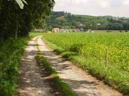
Route: The long " topform path" leads immediately after the start at the "Dannhoferweg" uphill through the forest in the direction of Breitwiesen. At km 1.95 the B 134 is crossed and it continues to Kitzing. Further on you reach the Edlgassen and after some time the village of Haag. Via the goods road "Hungerberg" and past the industrial park "Winkeln" you return to the Trattnach. Along the "Trattnachtallehrpfad" you will reach the sports ground Wallern again. This is a long route for athletes with good physical condition. At km 6.6 shortcut (via Mauerbergweg in the direction of Welser Straße) ...

 Interactive elevation profile

Download GPS data
Create PDF

Tour-Details

Starting place: 4702 Wallern an der Trattnach
Destination: 4702 Wallern an der Trattnach

duration: 4h 5m
length: 15,3 km
Altitude difference (uphill): 196m
Altitude difference (downhill): 194m

Lowest point: 290m
Highest point: 348m
difficulty: difficult
condition: difficult
panoramic view: Some Views

Paths covering:
Street, Hiking trail, Other

powered by TOURDATA
Protected by